At Graphgeo, we’re seasoned professionals in LiDAR mapping, harnessing our expertise in Spatial Technology and Geographic Information Systems (GIS) to deliver reliable geospatial solutions. With our expertise and cutting-edge technology, we provide accurate and actionable insights that inform decision-making and drive business outcomes.
Our team utilizes Light Detection and Ranging (LiDAR) technology, combining ground and aerial data to create precise topographical maps with accurate elevation and object location.
Our LiDAR solutions cater to a diverse range of industries, including:
Transportation
Oceanography
Forestry
Geological Mapping
Land Administration
Utilities
Location-based Services
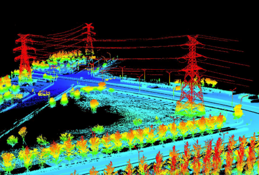
LiDAR (Light Detection and Ranging) points can be classified based on the type of object that reflected the laser pulse. This classification system allows for precise categorization of LiDAR data into various classes, including:
Bare earth or ground
Top of canopy
Water
These classes are defined using numeric integer codes in LAS or LAZ files, enabling accurate analysis and interpretation of LiDAR data. By classifying LiDAR points, we can extract valuable insights and create detailed models of the environment.
By leveraging our expertise and state-of-the-art technology, you can trust us to deliver high-quality GIS production services that meet your specific needs.